04 — GIS / GPS Mapping
Sub-centimeter
asset mapping
In conjunction with PACP inspection software, GIS mapping of each asset delivers robust location reporting at sub-centimeter accuracy — for both known assets and identified defects.
Map layers
- Known assets & identified defects
- Stormwater & sewer systems
- Utilities
- Irrigation systems
- Printed or digital output
The result is a visible document, printed or digital, that gives the owner quick reference to every asset and every area flagged for repair. Utilizing this technology alongside an inspection lets us report on exactly where assets are located, how they flow, where they flow, and where they discharge.
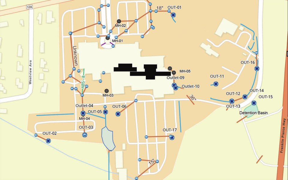 System map
Flip ↻
Facility-wide · 1:2,958
Every asset, one map
Catch basins, manholes, outlets, culverts, open channels, linear drains, and BMP and catchment boundaries, all on one layered map, with pipe sizes labeled.
View full map →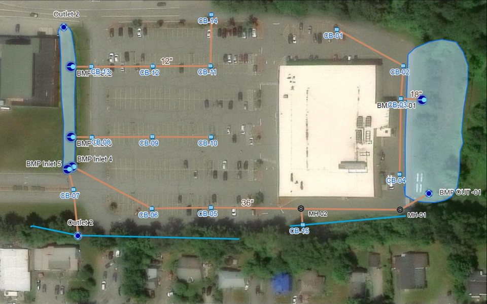 Aerial overlay
Flip ↻
Site detail · 1:1,479
Mapped over aerial imagery
Each catch basin is numbered and every culvert run is traced to its BMP inlet and outlet, with 12″, 18″ and 36″ lines and the catchment boundary drawn in.
View full map →Because assets can be layered, the same map can carry utilities, irrigation systems, sewer lines, and other infrastructure — a single source of truth inserted as layers on a digital or printed map. As systems age and repairs, modifications, and additions change what's below the surface, accurate mapping keeps your records matched to reality.