
05 — Inspection & Mapping Samples
See a real
inspection & map
Pages from completed project report booklets — coded CCTV imagery, certified MACP reporting, and sub-centimeter GIS mapping. Select any sample to view the full page.
 Sample 01
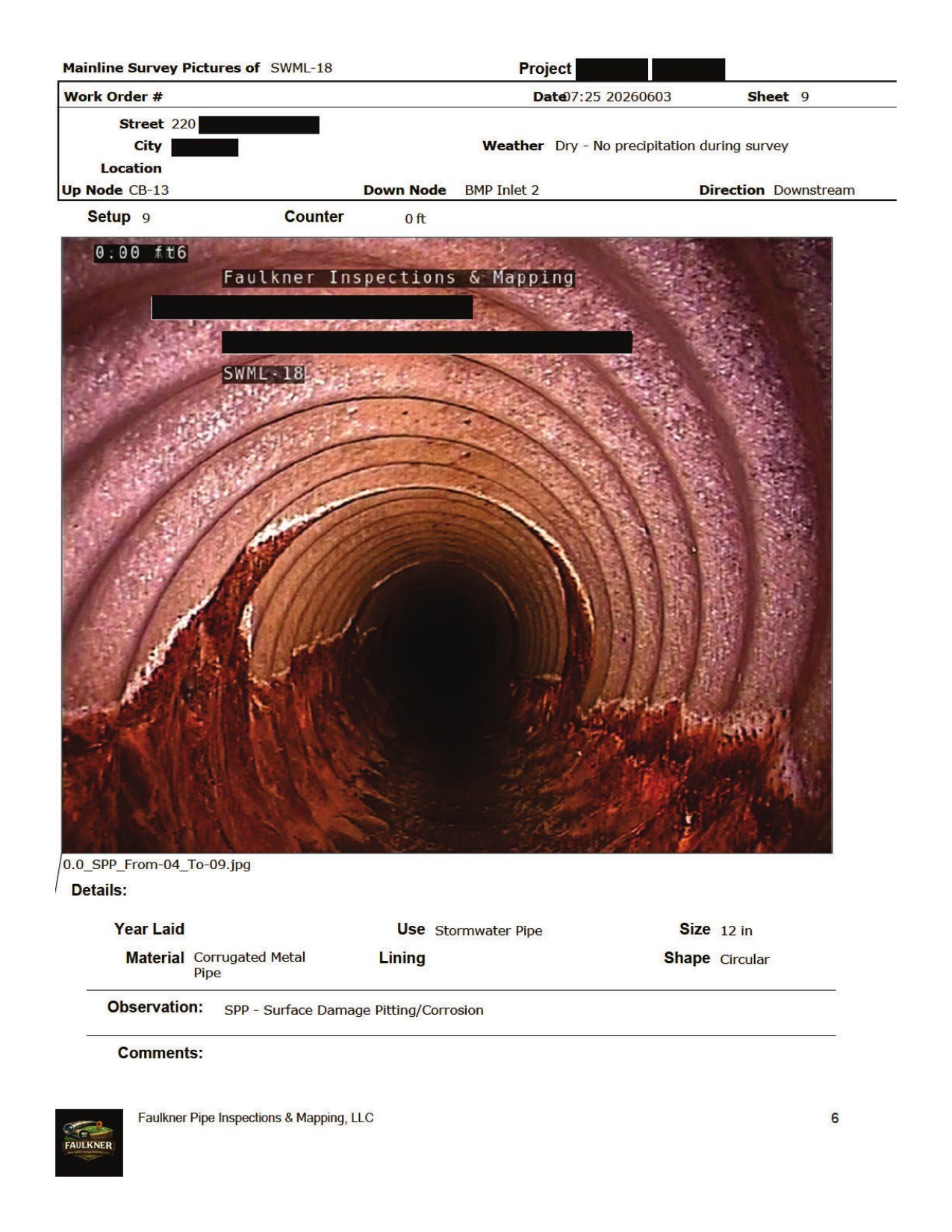
Mainline CCTV inspection
Robotic crawler footage of a 12″ corrugated metal stormwater pipe, coded to PACP — SPP surface pitting and corrosion from 4 to 9 o’clock.
View full report page →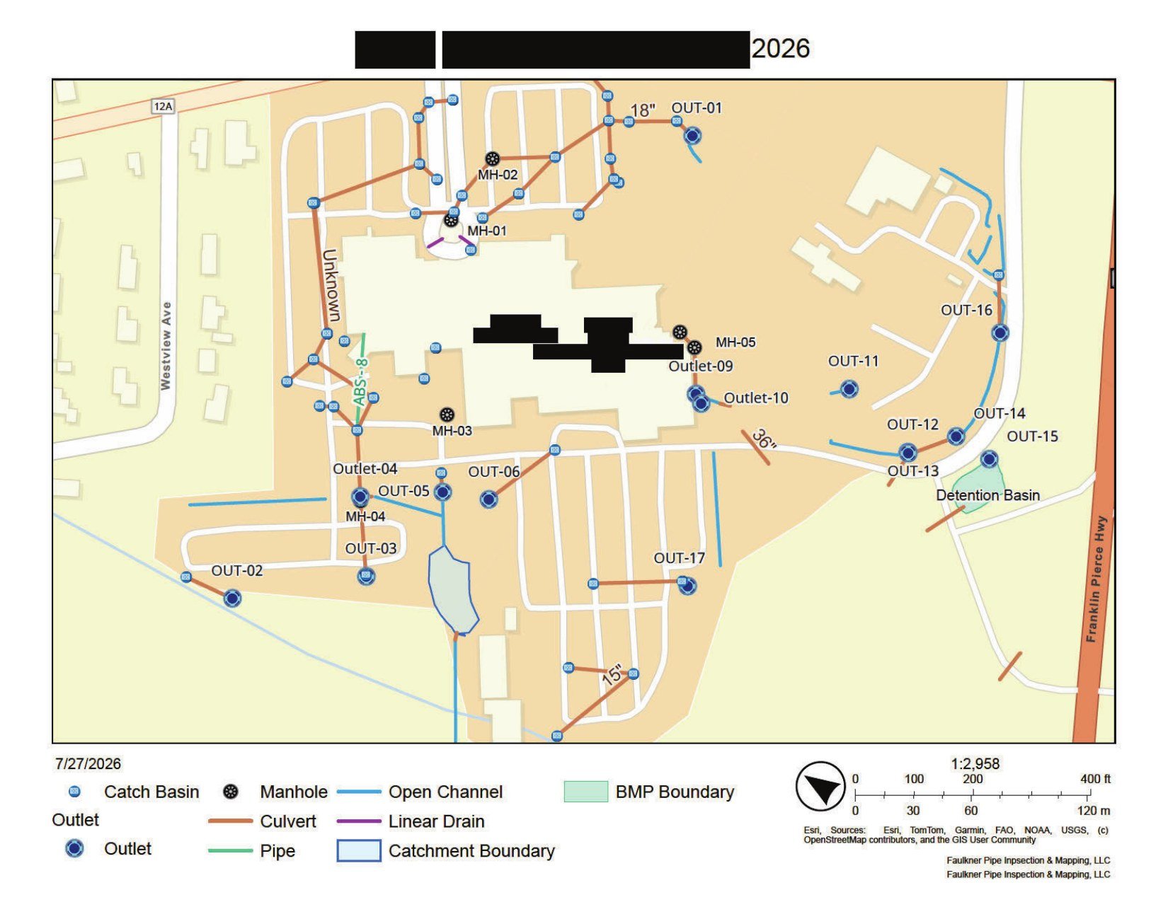 Sample 02
GIS stormwater system map
A facility-wide map locating every catch basin, manhole, outlet, culvert, open channel, and BMP — layered and printed or delivered digitally.
View full report page →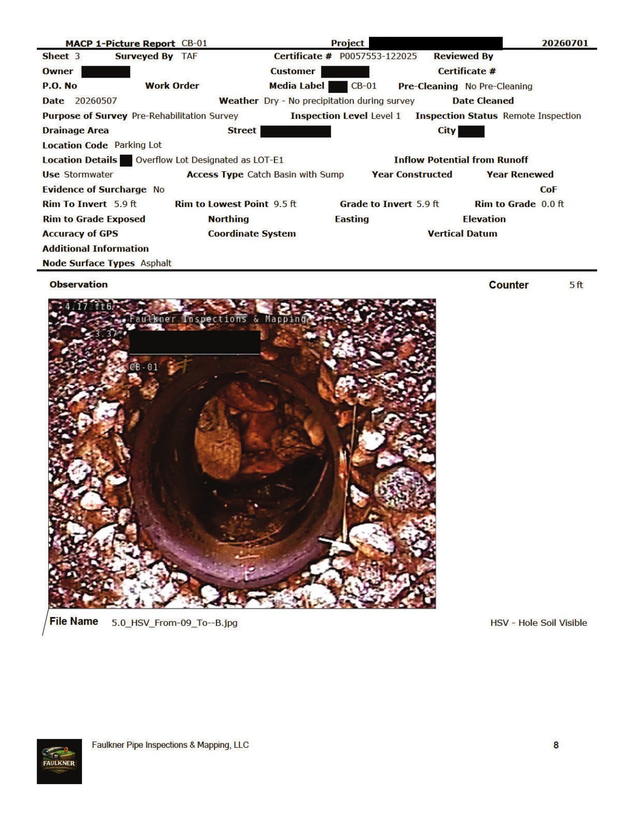 Sample 03
MACP catch basin report
A one-picture MACP report for a catch basin with sump — HSV, hole with soil visible, recorded at 5 ft.
View full report page →